Friends of Rotary Park

This is a service provided to the users of Rotary Park in Clarksville, Montgomery County, Tennessee. It is hosted by Friends of Rotary Park, a newly formed volunteer group that is dilligently working to improve the trail network at the park. This site provides information about current, past, and future trail development.

Name:

Rotary Park is a county-owned natural park in Clarksville, Montgomery County, Tennessee. It consists of two adjoining tracts of land that make up about 95 acres of mostly undeveloped, wooded land. There is one park entrance/exit that is paved and runs to the back of the park. There are three pavilions along the roadway with the largest being at the road's end. Rotary Park has an extensive trail network and is open to hikers and bikers. The new push for extensive trail work is necessary because most trails were improperly built by ATVs and motorcycles. Motorized vehicles are now banned from the park. Furthermore, the trails are showing signs of serious erosion. Most recently, a large amount of sustainable trail located outside of the park's boundary has been taken by development. The Friends of Rotary Park is dedicated to restoring and improving the park. Those interested in joining Friends of Rotary Park can do so by contacting Chris Clark at 931-801-3898. Dues are $25.00 for a family membership.

Wednesday, November 30, 2005

November 30, 2005

A very special thanks is owed to Dr. and Mrs. Hudson of Clarksville for their very generous donation.

Tuesday, November 29, 2005

Conservation Board Meeting

Dear Friends:
The Montgomery County Conservation Board is meeting at 5:00 p.m. on December 8, 2005, on the 3rd floor of the old courthouse. At the meeting, the county will be voting on park rules as well as making decisions on what to do about repairing the park post-tornado. Friends of Rotary Park will have representatives there on your behalf to lobby for a speedy and quality recovery of the park. The county is expecting to hear from our group and has asked that we elect only one or two representatives to voice our concerns. If you have any special concerns that you would like brought up at the meeting, please feel free to e-mail them to me at cgclark10@hotmail.com. Either J.R. or myself will present our concerns to the board.

Tuesday, November 22, 2005

November 22, 2005

A special "thank you" is owed to Jeff Purvis, David Adkins, and Queen City, Inc. for the $300 donation to Friends of Rotary Park. Also, I have word that two other large donations are soon coming our way. One of these is earmarked for the kiosk at pavilion 1.

On a more somber note, I have received word from Stacy Goodwin with Montgomery County Parks and Recreation that it may be a while before something can be done about the tornado damage at the park. At this time, she is working with three different county departments to get something done at the park. She has been told by the Safety Department to refrain from using volunteer labor to remove trees from the trails. I have requested that at least one member from our group be present when deciding which trails to be cleared and which ones to be rerouted. I am covered under the county's insurance policy and should be allowed to assist. At this time, most of the decisions are out of Stacy's hands as she deals with the proverbial government red tape. The decisions now seem to be in the hands of the bureaucrats, the county's insurance, and TEMA. Stacy continues to work very hard for the park and our group. She should be applauded for her hard work.

Please contact your county commissioners and request that the park be opened as soon as possible.

Chris

Saturday, November 19, 2005

Tornado Hits Park


Recent tornados have once again left the residents of Montgomery County with the challenge of cleaning up and rebuilding. It is with great sadness that I report that Rotary Park also fell victim to these most recent twisters. All three pavilions escaped with only minor damage. However, the forest and trail network were much less fortunate. Large trees are down all over the park leaving the trails impassable. For safety reasons, the County has closed the park pending clean up.
My heart goes out to those most affected by this tragedy: our neighbors and friends who have lost homes, cars, and businesses. I encourage everyone to help these people first and foremost. But for those who want to give extra, I encourage you to contribute to the cleanup of Rotary Park. Monetary contributions can be made to Friends of Rotary Park, 147 Welch Road, Clarksville, Tennessee 37043. One hundred percent of the proceeds will go to park cleanup and trail construction.

Tuesday, November 15, 2005

November 15, 2005

I completed two days of field research in Land Between the Lakes National Recreation Area this weekend, i.e. I went mountain biking. Seriously, for about a year now, I have closely observed the trail construction at the places I have ridden. I noticed that the topography around the North Welcome Center at L.B.L. is similar in a lot of ways to that of Rotary Park. Those trails were constructed many, many years ago and most have withstood the test of time. However, evidence of improperly benched trails was evident throughout the park. Based on what I saw, I plan on going back over the areas that have already been benched and benching them deeper and more fully, i.e. the upside of the cut will have a more gradual angle into the hillside. I.M.B.A. encourage's this and I now see why. In the areas at L.B.L. where this was not done, water erroded the bottom of the cut faster than the top, causing the hillside to hang over the trail tread. This creates a dangerous condition on the trial as well as making it less attractive visually.

With the recent rain (finally), the benched areas at Rotary should be packing down. I know that some of these areas have been difficult to pass, but this should change with the season. I will fix those areas that fell subject to the wind and gravity before the rain packed the new trail.

No official work day is scheduled at this time but will be soon. Stay tuned.

Chris

Thursday, November 03, 2005

Problems to be Addressed

The trail system at Rotary Park has numerous problems that must be addressed. First, inexperienced trail builders improperly built most of the trails. Many of the trails follow the fall line.[1] This has caused serious erosion problems. Also, the existing trail network has no theme or plan. Secondary trails branch in all directions. These trails are not well marked and there is no primary loop. Another problem is that the county, aside from a few hard working individuals, has taken very little interest in the park. All would agree that the County allocates inadequate funds for the park, which is clearly a gem in the rough. Perhaps the worst problem is that the park boundaries are poorly marked. This has lead to extensive trail building on private land. Many of these trails were taken last month by recent development near the park. The remaining trials located on private land are threatened and could be lost. The main goal of Friends of Rotary Park is to create a primary loop, which is to be contained completely within the park boundaries. All current trail work documented herein (the blog) is in furtherance of that goal.
[1] The "fall line" is the direction that water flows when pulled down by gravity.

Pre-Blog Trail Work

The first major trail work by Friends of Rotary Park was done on the first trial located on the right at the park entrance. This section of trail was rarely used due to its difficulty and major erosion problems. The old trail followed the fall line up and down the steep hills. This trail was a novice rider's nightmare. Hikers had to be very cautious not to trip over the many exposed roots. At one point, the trial followed a dry creek-bed. The re-route was built to IMBA[1] standards, meandering between trees and traversing the hills with numerous switchbacks. The trail crosses two gullies, which have been filled and paved with large rocks for a smooth trail tread. This trail is tight and technical (a must in such a small park) and is now a favorite of novice as well as expert bikers. The hikers sing its praises as well as it added sustainable trail. The only complaints come from the Rossview High School cross-country team, who is made to train on it weekly; they have named the trail "ironman."

The trial is short but very fast. For speed, start at the park entrance on the right. Hug trees on the numerous switchbacks, and then descend a short, but very steep, hill. From that point, glide effortlessly over the rock bridges and the log jump at the end of the trail. The trail ends at Pavilion Two, a jumping point for numerous trailheads. When the primary loop is complete, this section of trail will become the beginning/end of the loop.

The second major re-route was done further into the park on the hill above the Boy Scout Bridge.[2] The access to this trail is on the left at the park entrance. The old trail was a 200-foot fall line trail that went straight down the hill beside several large trees. Like most large trees, these had large roots that were becoming more exposed with every rain. The descent was very rough and only the most skilled mountain bikers could climb the trail. Hikers could climb it in just a few minutes but their heart rate would climb with the assent.

The new trail shifts the old one up the hill about 300 yards (a third re-route, opened October 30, 2005, connects the two). Instead of going straight down hill, the trail turns right immediately. Upon entering the tree line, the section that follows is benched and meanders slightly, traversing up and down the hill. Just before it meets the old trail, a large 180-degree descending turn sends riders slightly down hill. This area required substantial benching. It is on the up side of the large trees so erosion should not be a problem in the future. All large roots were removed. Both hikers and bikers will enjoy the spectacular view of the Boy Scout Bridge. There is a slight climb just before the second descending turn. This was done for erosion control and to have room for the turn. The turn still came out pretty tight because it backs up to the park boundary. The remaining decent is the steepest of the section. It may run afoul with I.M.B.A.'s 50 percent rule but is far less steep than the old trail. This section is probably the deepest bench-cut trail in the park. Special thanks to Glen for his help with the benching (which took two people over 20 hours to complete). This re-route was completed in August 2005.
[1] I.M.B.A. is the official acronym for the International Mountain Bike Association. IMBA distributes a trail guide that is considered by most as the standard for properly built multiuse trails.
[2] Although the Boy Scouts have built both bridges in the park, this is a reference to the first and largest of the two bridges. It spans a 30-foot wide, 10-foot deep gorge that had to be walked prior to the bridge being built.

Wednesday, November 02, 2005

October 31, 2005

October 31, 2005 – Yesterday I completed the third major re-route on this project. This section of trail is located about a quarter of a mile into the main loop when entering on the left at the park entrance. This area is commonly referred to as the "Big V," the "ditch," or the "gulch." This is the steepest section of trail as well as the most difficult climb in the park. This re-route is on the second half of the "V" and only addresses half of the problem. The remaining portion is in the TVA easement that runs though the park. It will require cutting down very thick thistle and substantial benching. This remaining portion should be re-route number four and is expected to be complete by year's end. Once complete, all four re-routed sections will be connected.

The idea for this re-route comes from the Canal Loop portion of the North South trail in Land Between the Lakes National Recreation Area. The problem is that there are two large hills side-by-side. The old trail climbs up the first hill, through the TVA easement, and then follows the fall line straight down the hill. It then climbes straight up the second hill, completing the "V." This section has claimed many a novice biker and almost made my girlfriend quite the sport (this was the spot of her first big wreck). The overall plan is to go around the first hill by traversing its south face, completing a switchback in the valley floor and meandering slowly up and across the second hill's north face. The section of trail completed yesterday was the second half of the switchback and the trail work on the second hill's north face.

This may be the most fun section of trail in the park (I don't think it has been ridden yet but one look at the trail reminds me so much of Montgomery Bell, it has to be fun. Tommy Hatcher will be proud
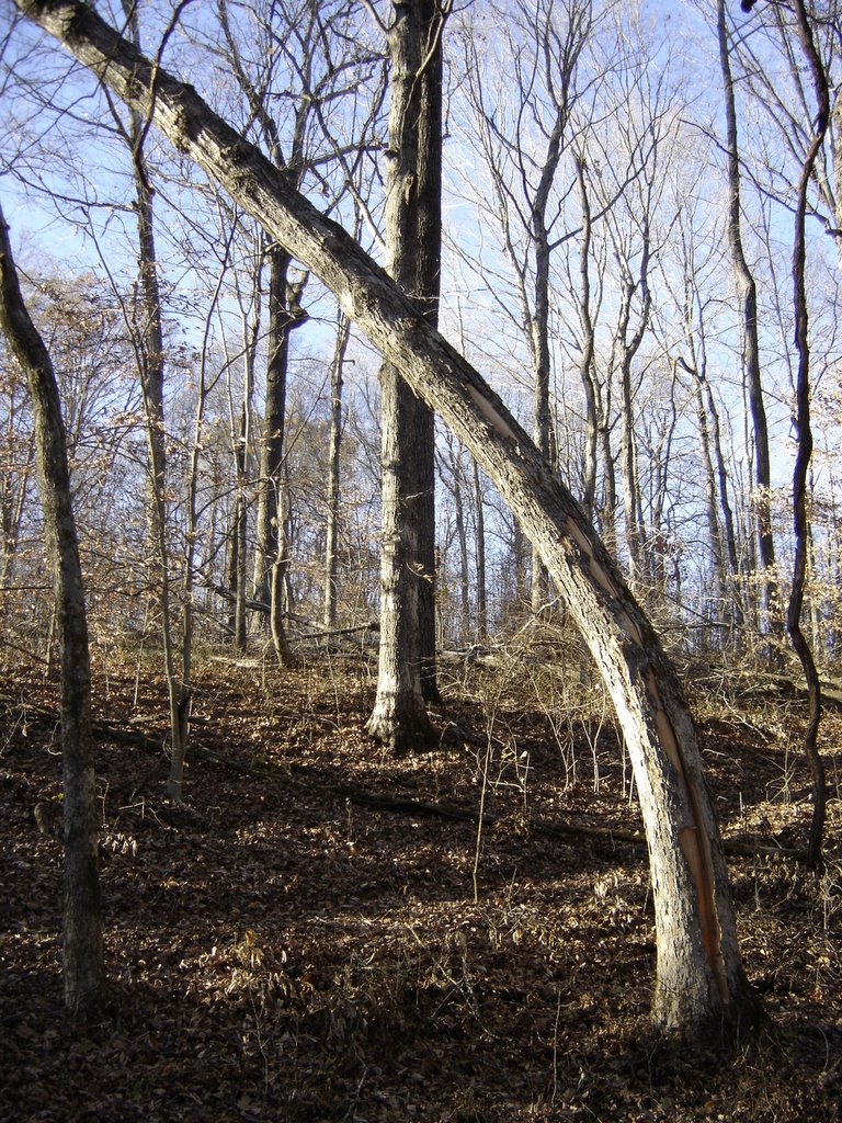
[1]). The completed section begins in the valley switchback. It turns right beginning the climb. This section required benching a short section; when time permits, I may bench about one hundred more feet. It travels over natural dips and humps that will keep it interesting. The first climbing turn comes quick, right on the edge of the TVA easement. This required substantial thorn and vine removal as well as tree pruning. The beginning and end of the switchback crosses a downed tree. Although this may get annoying and have to be removed later, it will help with erosion control until the turn can be replaced with a rolling crown switchback. I have tried to build logrolls over them but they will need to be improved at a later date.

After the first big turn, the trail traverses across the hillside about half way up the hill. The trail crosses the old trail perfectly perpendicular. It follows the contour of the hill with a big, slow left turn where it makes the second big switchback. This is a medium to slow right turn that will require novice riders to get out of the saddle or shift low. Experienced riders will have no problem maintaining their speed through the turn. The trail meanders across the contour of the hill beside large trees before turning left up the hill. This begins a gradual climb to the edge of the park boundary. I concede that this 200-yard climb is a fall-line trail. However, even the IMBA trail crew would have chosen this route as it climbs over a natural hump and into a natural dip that, together, create a perfect "rolling-grade dip" for erosion control. More importantly, it goes between three very large oak trees uncommonly clustered together in this area of the park. Although it is a fall-line trail, the natural landscape, large trees, and very gradual slope will easily downplay the effects of erosion. Should erosion become a problem, there is plenty of good space to re-route the trail.

After going trough the tree cluster, a slight right turn allows the trail to hug the park's northeastern boundary. The trail gets tight here, as the trees are more plentiful. I, for one, can't wait to feel my shoulders brush these trees as I throw the bike side-to-side to keep my speed through the narrow slot. I don't even want to talk about all of the thorns and vines that had to be removed from this section. If anyone gets a flat here, it is not my fault. This marks the top of the hill, the end of this re-route, and the beginning of re-route number two. The section ends with the old ATV trail[2]

If this third re-routed section were to have a name, it would have to be "Thorn Pass" due to the abundance of thorn vines found here. I bet I saved 5 to 10 trees from doom by cutting the vines out of them. This slowed the trail building process but will help keep this area as one of the most beautiful spots in the park.

I thought a lot about how I was going to re-route this section. I visited this section for over four months. Some routes were clear; other problems seemed insurmountable. A drainage basin for the electrical power station on a flanking hill severely limited the possibilities. Despite the challenges, patience and research won out. I am very happy with this new section and I believe most everyone else will be as well. Some of the hardcore mountain bikers will be disappointed that the old section is being closed; it was a real challenge that could not be found in other parks (sorry Stacy). Overall, though, it was a nuisance that kept potential users out of the park. With this re-routed section open, park users will be able to get an idea of how the completed loop will be styled.
[1] Tommy Hatcher is the primary designer of the mountain bike trails at Montgomery Bell State Park. These trails are fast becoming known as some of the best-built and maintained trails in the Southeast.
[2] This is a poorly constructed fall-line trail that is being closed. It is a point-to-point trail that bisects the park on the Northeastern side. It used to connect the park to the K-Mart parking lot. K-Mart, showing uncompromised wisdom, closed the trailhead by erecting a very large, very long chain link fence. This stopped the Jeeps and four-wheelers. Horses still use it but it is a biker's worse nightmare as the trail tread is covered in large, round rocks. Bikers and hikers should avoid this trail.